Geolocate

Langgam topographic map

Click on the map to display elevation.

About this map

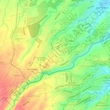
Name: Langgam topographic map, elevation, terrain.

Location: Langgam, San Pedro, Laguna, Calabarzon, 4023, Philippines (14.32136 121.00754 14.33576 121.02351)

Average elevation: 90 m

Minimum elevation: 45 m

Maximum elevation: 131 m

Gear up for your next adventure:

🌂Windproof Trekking Umbrellas - Surprising but effective rain protection on low-wind trails
👕Technical Hiking Tees - Moisture-management for high-exertion climbs
🔦Waterproof LED Headlamps - Hands-free lighting for evening treks and emergency navigation
🧺Microfibre Travel Towels - Fast-drying and compact towels for wild swimming and camping
🧘Folding Sit Mats - Dry and warm seat for map-reading breaks on damp ground

As an Amazon Associate, this site earns from qualifying purchases at no extra cost to you.