Geolocate

Paderborn topographic map

Click on the map to display elevation.

About this map
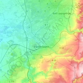
Name: Paderborn topographic map, elevation, terrain.

Location: Paderborn, Kreis Paderborn, North Rhine-Westphalia, Germany (51.65423 8.63629 51.80084 8.90059)

Average elevation: 164 m

Minimum elevation: 89 m

Maximum elevation: 362 m

Other topographic maps

Click on a map to view its topography, its elevation and its terrain.
Gear up for your next adventure:

🧢Waterproof Hiking Hats - Keep the rain off your face while studying topographic maps
🌄Compact Monoculars - Lightweight optics for hiking
🥤Hydration Bladders - Hands-free hydration systems for backpacks
🌂Windproof Trekking Umbrellas - Surprising but effective rain protection on low-wind trails
🌦️Portable Weather Meters - Handheld tools for monitoring weather conditions

As an Amazon Associate, this site earns from qualifying purchases at no extra cost to you.