Geolocate

Haßloch topographic map

Click on the map to display elevation.

About this map
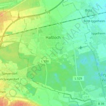
Name: Haßloch topographic map, elevation, terrain.

Location: Haßloch, Landkreis Bad Dürkheim, Rhineland-Palatinate, 67454, Germany (49.31132 8.21622 49.39104 8.31744)

Average elevation: 115 m

Minimum elevation: 103 m

Maximum elevation: 140 m

Other topographic maps

Click on a map to view its topography, its elevation and its terrain.

Gear up for your next adventure:

🛰️Satellite Messengers - Emergency communication devices for areas without mobile signal
👟Waterproof Leg Gaiters - Keep mud and water out of your boots in boggy terrain
🧺Microfibre Travel Towels - Fast-drying and compact towels for wild swimming and camping
🧺Ultralight Dry Bags - Organize and waterproof your gear inside your rucksack
🧴Tick Removal Tools - Small, essential health tool for UK woodland and moorland

As an Amazon Associate, this site earns from qualifying purchases at no extra cost to you.