Geolocate

Mombercelli topographic map

Click on the map to display elevation.

About this map
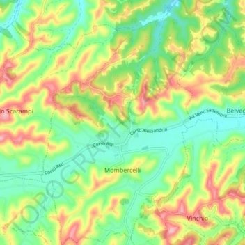
Name: Mombercelli topographic map, elevation, terrain.

Location: Mombercelli, Asti, Piedmont, Italy (44.80153 8.27009 44.85407 8.32719)

Average elevation: 188 m

Minimum elevation: 125 m

Maximum elevation: 279 m

Other topographic maps

Click on a map to view its topography, its elevation and its terrain.

Gatti

Italy > Piedmont > Asti > Rocchetta Tanaro

Average elevation: 165 m

Sant'Andrea

Italy > Piedmont > Asti > Cerreto d'Asti

Average elevation: 270 m

Zolfo

Italy > Piedmont > Asti > Montafia

Average elevation: 226 m

Gear up for your next adventure:

🦟Anti-Midge & Tick Repellent - Vital for hiking in the Scottish Highlands during summer
🧼Technical Clothing Wash - Special soap to clean and restore waterproof membranes
🚲Cycling GPS Computers - Track elevation and topographic routes on two wheels
🧥Breathable Waterproof Jackets - Essential rain protection for the unpredictable British climate
🩹Hiking First Aid Kits - Compact medical kits tailored for trail injuries and emergencies

As an Amazon Associate, this site earns from qualifying purchases at no extra cost to you.