
Darfur topographic map
Interactive map
Click on the map to display elevation.
About this map
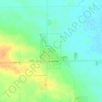
Name: Darfur topographic map, elevation, terrain.
Location: Darfur, Watonwan County, Minnesota, 56022, United States (44.04874 -94.84189 44.05789 -94.83202)
Average elevation: 349 m
Minimum elevation: 337 m
Maximum elevation: 369 m
Other topographic maps
Click on a map to view its topography, its elevation and its terrain.
St. James
United States > Minnesota > Watonwan County
St. James, Watonwan County, Minnesota, 56081, United States
Average elevation: 328 m