Geolocate

Korba topographic map

Click on the map to display elevation.

About this map

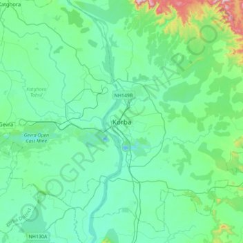
Name: Korba topographic map, elevation, terrain.

Location: Korba, Korba Tahsil, Korba, Chhattisgarh, 495600, India (22.19475 82.55109 22.51475 82.87109)

Average elevation: 322 m

Minimum elevation: 225 m

Maximum elevation: 830 m

Gear up for your next adventure:

🧤Thermal Touchscreen Gloves - Stay warm while operating your GPS or smartphone camera
🧣Neck Gaiters - Protects against wind and sun on exposed ridges and peaks
🛌Sleeping Bags - Warm and packable sleeping bags for outdoor nights
🧵Survival Paracord - Multi-purpose cordage for emergency repairs and shelters
👟Women's Trail Running Shoes - Agile footwear for fell running and technical trails

As an Amazon Associate, this site earns from qualifying purchases at no extra cost to you.