Geolocate

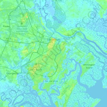
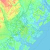
Savannah topographic map

Click on the map to display elevation.

Savannah

Savannah is prone to flooding, due to abundant rainfall, an elevation at just above sea level, and the shape of the coastline, which poses a greater surge risk during hurricanes. The city currently uses five canals. In addition, several pumping stations have been built to help reduce the effects of flash flooding.

Wikipedia (CC-BY-SA 3.0)

About this map

Name: Savannah topographic map, elevation, terrain.

Location: Savannah, Chatham County, Georgia, United States (31.88785 -81.37143 32.18966 -81.02952)

Average elevation: 4 m

Minimum elevation: -5 m

Maximum elevation: 33 m

Other topographic maps

Click on a map to view its topography, its elevation and its terrain.
Rio Vista

United States > Georgia > Chatham County

Average elevation: 3 m

Oakdale

United States > Georgia > Chatham County > Savannah

Average elevation: 10 m

Welwood

United States > Georgia > Chatham County > Savannah

Average elevation: 7 m

Gear up for your next adventure:

🧘Folding Sit Mats - Dry and warm seat for map-reading breaks on damp ground
Lightweight Tents - Compact tents for backpacking and trekking
🗺️Ordnance Survey Maps - Essential paper maps for hiking across the UK national parks
🔋Solar Power Banks - Keep your GPS and phone charged during multi-day expeditions
🥾Hiking Boot Waterproofing Wax - Maintain the lifespan of your leather trekking boots

As an Amazon Associate, this site earns from qualifying purchases at no extra cost to you.