
Make a donation
Gear up for your next adventure:
As an Amazon Associate, this site earns from qualifying purchases at no extra cost to you.
Neyveli topographic map
Click on the map to display elevation.
Make a donation
Gear up for your next adventure:
As an Amazon Associate, this site earns from qualifying purchases at no extra cost to you.
Neyveli
Neyveli is located at 11°36′N 79°29′E / 11.60°N 79.48°E / 11.60; 79.48. It has an average elevation of 87 metres (285 ft). It is located along with the Chennai-Thanjavur National Highway. Neyveli was a planned township and is sub-divided into 'blocks'. There are 32 blocks with each block measuring 1 kilometre (0.62 mi) by 0.7 kilometres (0.43 mi) separated by double-lane roads. Each block has streets which are uniquely named. The township houses nearly 15,000 houses and apartments. Neyveli has a low-moderate tropical climate with hot summers and cool winters. It has red soil, which is cultivable.
Make a donation
Gear up for your next adventure:
As an Amazon Associate, this site earns from qualifying purchases at no extra cost to you.
About this map
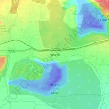
Name: Neyveli topographic map, elevation, terrain.
Average elevation: 23 m
Minimum elevation: -65 m
Maximum elevation: 96 m
Make a donation
Gear up for your next adventure:
As an Amazon Associate, this site earns from qualifying purchases at no extra cost to you.