
Maro topographic map
Interactive map
Click on the map to display elevation.
About this map
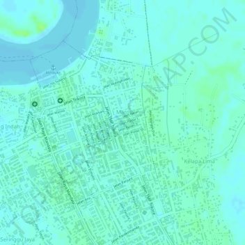
Name: Maro topographic map, elevation, terrain.
Location: Maro, Merauke, South Papua, Indonesia (-8.49291 140.38782 -8.47491 140.40205)
Average elevation: 5 m
Minimum elevation: 1 m
Maximum elevation: 12 m
Other topographic maps
Click on a map to view its topography, its elevation and its terrain.
Bupul Indah
Indonesia > South Papua > Merauke
Bupul Indah, Merauke, South Papua, Western New Guinea, Indonesia
Average elevation: 28 m
Muting
Indonesia > South Papua > Merauke
Muting, Merauke, South Papua, Western New Guinea, Indonesia
Average elevation: 13 m
Kimaam
Indonesia > South Papua > Merauke
Kimaam, Merauke, South Papua, Western New Guinea, Indonesia
Average elevation: 5 m
Poo
Indonesia > South Papua > Merauke
Poo, Merauke, South Papua, Western New Guinea, Indonesia
Average elevation: 7 m