Geolocate

Fangataufa topographic map

Click on the map to display elevation.

About this map
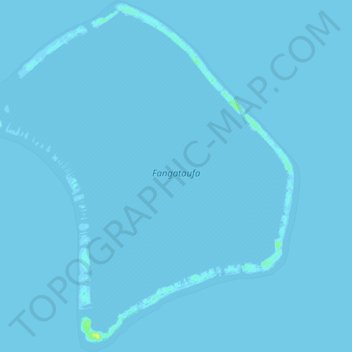
Name: Fangataufa topographic map, elevation, terrain.

Location: Fangataufa, Tureia, Tuamotu-Gambier, French Polynesia, 98784, France (-22.28376 -138.79274 -22.19446 -138.70150)

Average elevation: 0 m

Minimum elevation: -1 m

Maximum elevation: 16 m

Other topographic maps

Click on a map to view its topography, its elevation and its terrain.

Moruroa

France > French Polynesia > Tureia

Average elevation: 0 m

Tematangi

France > French Polynesia > Tureia

Average elevation: 0 m

Tureia

France > French Polynesia > Tureia

Average elevation: 0 m

Vanavana

France > French Polynesia > Tureia

Average elevation: 0 m

Vanavana

France > French Polynesia > Tureia

Average elevation: 0 m

Gear up for your next adventure:

📻Hand-Crank Emergency Radios - Stay updated on weather warnings in remote areas
🔋Lithium AA Batteries - Long-lasting power that performs well in cold mountain weather
🥤Hiking Water Bottles - Reusable bottles for hydration on the trail
🎒Backpack Rain Covers - Universal waterproof covers to protect your gear from downpours
🚲Cycling GPS Computers - Track elevation and topographic routes on two wheels

As an Amazon Associate, this site earns from qualifying purchases at no extra cost to you.