

Tepic topographic map
Click on the map to display elevation.
Tepic
Located in the central part of the state, it stands at an altitude of 915 metres (3,002 ft) above sea level, on the banks of the Río Mololoa and the Río Tepic, approximately 225 kilometres (140 mi) north-west of Guadalajara, Jalisco. Nearby are the volcanoes of San Juan, Las Navajas, and Sangangüey. Tepic is the primary urban center of this rich agricultural region; major crops include sugarcane, tobacco and citrus fruits.
About this map
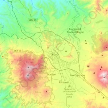
Name: Tepic topographic map, elevation, terrain.
Location: Tepic, Nayarit, 63000, Mexico (21.35192 -105.05159 21.67192 -104.73159)
Average elevation: 921 m
Minimum elevation: 147 m
Maximum elevation: 2,317 m