
Thank you for supporting this site ❤️
Make a donation
Make a donation
Gear up for your next adventure:
As an Amazon Associate, this site earns from qualifying purchases at no extra cost to you.
Cabadbaran topographic map
Click on the map to display elevation.
Thank you for supporting this site ❤️
Make a donation
Make a donation
Gear up for your next adventure:
As an Amazon Associate, this site earns from qualifying purchases at no extra cost to you.
About this map
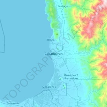
Name: Cabadbaran topographic map, elevation, terrain.
Location: Cabadbaran, Agusan del Norte, Caraga, 6805, Philippines (8.96330 125.37222 9.28330 125.69222)
Average elevation: 179 m
Minimum elevation: -2 m
Maximum elevation: 1,751 m
Thank you for supporting this site ❤️
Make a donation
Make a donation
Gear up for your next adventure:
As an Amazon Associate, this site earns from qualifying purchases at no extra cost to you.