
Thank you for supporting this site ❤️
Make a donation
Make a donation
Gear up for your next adventure:
As an Amazon Associate, this site earns from qualifying purchases at no extra cost to you.
الرابية topographic map
Click on the map to display elevation.
Thank you for supporting this site ❤️
Make a donation
Make a donation
Gear up for your next adventure:
As an Amazon Associate, this site earns from qualifying purchases at no extra cost to you.
About this map
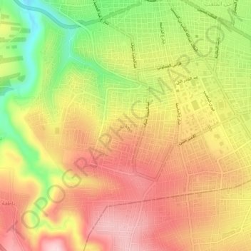
Name: الرابية topographic map, elevation, terrain.
Location: الرابية, حوارة, Irbid Qasabah District, Irbid, 21162, Jordan (32.51436 35.82221 32.55436 35.86221)
Average elevation: 603 m
Minimum elevation: 455 m
Maximum elevation: 712 m
Thank you for supporting this site ❤️
Make a donation
Make a donation
Gear up for your next adventure:
As an Amazon Associate, this site earns from qualifying purchases at no extra cost to you.