
Make a donation
Gear up for your next adventure:
As an Amazon Associate, this site earns from qualifying purchases at no extra cost to you.
Miraleste topographic map
Click on the map to display elevation.
Make a donation
Gear up for your next adventure:
As an Amazon Associate, this site earns from qualifying purchases at no extra cost to you.
About this map
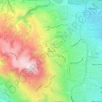
Name: Miraleste topographic map, elevation, terrain.
Average elevation: 201 m
Minimum elevation: 24 m
Maximum elevation: 453 m
Make a donation
Gear up for your next adventure:
As an Amazon Associate, this site earns from qualifying purchases at no extra cost to you.
Other topographic maps
Click on a map to view its topography, its elevation and its terrain.
Palos Verdes
United States > California > Los Angeles County > Rancho Palos Verdes
Average elevation: 49 m
Palos Verdes
United States > California > Los Angeles County > Rancho Palos Verdes
Average elevation: 49 m
Abalone Cove State Marine Conservation Area
United States > California > Los Angeles County > Rancho Palos Verdes
Average elevation: 4 m