
San Carlos topographic map
Interactive map
Click on the map to display elevation.
About this map
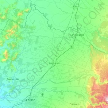
Name: San Carlos topographic map, elevation, terrain.
Average elevation: 200 m
Minimum elevation: 57 m
Maximum elevation: 948 m
Other topographic maps
Click on a map to view its topography, its elevation and its terrain.
Cachapoal
Chile > Ñuble Region > Provincia de Punilla > San Carlos
Cachapoal, San Carlos, Provincia de Punilla, Ñuble Region, Chile
Average elevation: 313 m