
Winchester topographic map
Interactive map
Click on the map to display elevation.
About this map
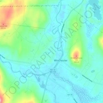
Name: Winchester topographic map, elevation, terrain.
Location: Winchester, Cheshire County, New Hampshire, United States (42.75942 -72.40901 42.79356 -72.35749)
Average elevation: 167 m
Minimum elevation: 126 m
Maximum elevation: 302 m
Other topographic maps
Click on a map to view its topography, its elevation and its terrain.
Pisgah State Park
United States > New Hampshire > Cheshire County > Winchester
Pisgah State Park, Winchester, Cheshire County, New Hampshire, United States
Average elevation: 250 m