Geolocate

Elkins topographic map

Click on the map to display elevation.

About this map

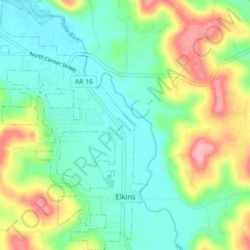
Name: Elkins topographic map, elevation, terrain.

Location: Elkins, Washington County, Arkansas, United States (35.99049 -94.05539 36.04200 -94.00287)

Average elevation: 400 m

Minimum elevation: 358 m

Maximum elevation: 486 m

Other topographic maps

Click on a map to view its topography, its elevation and its terrain.

Durham

United States > Arkansas > Washington County

Average elevation: 411 m

Sonora

United States > Arkansas > Washington County

Average elevation: 388 m

Pinnacle

United States > Arkansas > Washington County

Average elevation: 360 m

Wyman

United States > Arkansas > Washington County

Average elevation: 377 m

Canehill

United States > Arkansas > Washington County

Average elevation: 446 m

Savoy

United States > Arkansas > Washington County

Average elevation: 348 m

Sunset

United States > Arkansas > Washington County

Average elevation: 628 m

Evansville

United States > Arkansas > Washington County

Average elevation: 376 m

Strickler

United States > Arkansas > Washington County

Average elevation: 486 m

Hogeye

United States > Arkansas > Washington County

Average elevation: 414 m

Gear up for your next adventure:

👟Heavy Duty Boot Laces - Always carry a spare for your hiking footwear
GPS Outdoor Watches - Watches with GPS tracking for hiking and exploration
🧊Insulated Flasks - Keeps drinks hot or cold during hikes
📦Compression Sacks - Reduce backpack volume efficiently
🚲Cycling GPS Computers - Track elevation and topographic routes on two wheels

As an Amazon Associate, this site earns from qualifying purchases at no extra cost to you.