
Gorgan topographic map
Interactive map
Click on the map to display elevation.
About this map
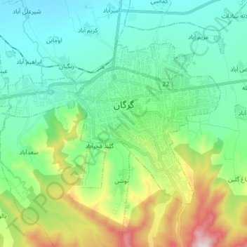
Name: Gorgan topographic map, elevation, terrain.
Location: Gorgan, بخش مرکزی, Gorgan County, Golestan Province, Iran (36.79485 54.34893 36.86619 54.48563)
Average elevation: 182 m
Minimum elevation: 1 m
Maximum elevation: 718 m
Other topographic maps
Click on a map to view its topography, its elevation and its terrain.
Pasargad
Iran > Golestan Province > Gorgan County > Gorgan
Pasargad, Gorgan, بخش مرکزی, Gorgan County, Golestan Province, Iran
Average elevation: 353 m