Geolocate

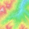
Camerana topographic map

Click on the map to display elevation.

About this map

Name: Camerana topographic map, elevation, terrain.

Location: Camerana, Cuneo, Piedmont, 12072, Italy (44.39482 8.10150 44.46263 8.16617)

Average elevation: 565 m

Minimum elevation: 350 m

Maximum elevation: 794 m

Other topographic maps

Click on a map to view its topography, its elevation and its terrain.

Pianche

Italy > Piedmont > Cuneo

Average elevation: 1,496 m

Montescotto

Italy > Piedmont > Cuneo > Barge

Average elevation: 643 m

Bertolini

Italy > Piedmont > Cuneo > Crissolo

Average elevation: 1,686 m

Pievetta

Italy > Piedmont > Cuneo

Average elevation: 735 m

Monastero

Italy > Piedmont > Cuneo > Mondovì

Average elevation: 448 m

San Bernolfo

Italy > Piedmont > Cuneo > Vinadio

Average elevation: 2,036 m

Gear up for your next adventure:

💧Hydration Reservoirs - Convenient water bladders for hands-free drinking on the move
🥄Titanium Camping Sporks - The ultimate lightweight utensil for trail meals
🗺️Topographic Maps - Detailed maps showing elevation and terrain features
🧥Breathable Waterproof Jackets - Essential rain protection for the unpredictable British climate
🌄Compact Monoculars - Lightweight optics for hiking

As an Amazon Associate, this site earns from qualifying purchases at no extra cost to you.