Geolocate

Eelde topographic map

Click on the map to display elevation.

About this map

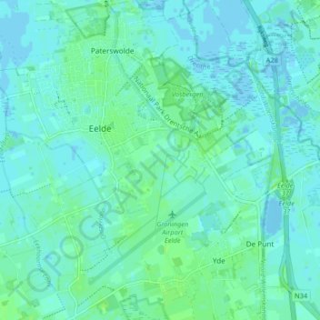
Name: Eelde topographic map, elevation, terrain.

Location: Eelde, Tynaarlo, Drenthe, Netherlands (53.11083 6.53821 53.14871 6.61920)

Average elevation: 3 m

Minimum elevation: -2 m

Maximum elevation: 9 m

Gear up for your next adventure:

🧣Fleece Neck Warmers - Extra insulation for winter topographic surveys
🪓Outdoor Multitools - Versatile tools for hiking and camping
🔋Lithium AA Batteries - Long-lasting power that performs well in cold mountain weather
🧥Breathable Waterproof Jackets - Essential rain protection for the unpredictable British climate
🔋Solar Chargers - Eco-friendly charging solutions for outdoor use

As an Amazon Associate, this site earns from qualifying purchases at no extra cost to you.