Geolocate

Collem topographic map

Click on the map to display elevation.

About this map

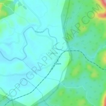
Name: Collem topographic map, elevation, terrain.

Location: Collem, Dharbandora, South Goa, Goa, 403410, India (15.31714 74.22275 15.35714 74.26275)

Average elevation: 90 m

Minimum elevation: 58 m

Maximum elevation: 234 m

Gear up for your next adventure:

🧭GPS Trackers - Tracking devices for safety and navigation
🛰️Handheld GPS Devices - Reliable GPS units for hiking and outdoor navigation
🔦LED Camping Lanterns - Illumination for reading maps inside your tent at night
🥼Base Layers - Thermal base layers for temperature regulation
❄️Walking Crampons - Added traction for icy slopes and winter peak bagging

As an Amazon Associate, this site earns from qualifying purchases at no extra cost to you.