
Sterling topographic map
Interactive map
Click on the map to display elevation.
About this map
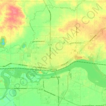
Name: Sterling topographic map, elevation, terrain.
Location: Sterling, Whiteside County, Illinois, 61081, United States (41.78309 -89.75764 41.82001 -89.64068)
Average elevation: 203 m
Minimum elevation: 172 m
Maximum elevation: 238 m
Other topographic maps
Click on a map to view its topography, its elevation and its terrain.
Linda Lake
United States > Illinois > Whiteside County
Linda Lake, Whiteside County, Illinois, United States
Average elevation: 189 m