Geolocate

El Paso Natural Gas Dam Number 5 topographic map

Click on the map to display elevation.

About this map
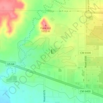
Name: El Paso Natural Gas Dam Number 5 topographic map, elevation, terrain.

Location: El Paso Natural Gas Dam Number 5, Kirtland, San Juan County, New Mexico, 87417, United States (36.75286 -108.37091 36.75395 -108.37065)

Average elevation: 1,604 m

Minimum elevation: 1,564 m

Maximum elevation: 1,658 m

Gear up for your next adventure:

📸Action Camera Chest Mounts - Record your ascent following topographic paths hands-free
🧼Biodegradable Soap - Leave-no-trace hygiene for multi-day mountain treks
🔋Lithium AA Batteries - Long-lasting power that performs well in cold mountain weather
🍲Portable Camping Stoves - Fast-boiling stoves for hot meals on remote topographic survey trips
📻Hand-Crank Emergency Radios - Stay updated on weather warnings in remote areas

As an Amazon Associate, this site earns from qualifying purchases at no extra cost to you.