Geolocate

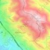
Bay Farm Island topographic map

Click on the map to display elevation.

About this map

Name: Bay Farm Island topographic map, elevation, terrain.

Location: Bay Farm Island, Oakland, Alameda County, California, United States (37.69926 -122.26117 37.74816 -122.19711)

Average elevation: 1 m

Minimum elevation: -7 m

Maximum elevation: 23 m

Other topographic maps

Click on a map to view its topography, its elevation and its terrain.
Gear up for your next adventure:

🧦Hiking Socks - Breathable socks designed to prevent blisters on long walks
🔭Compact Hiking Binoculars - Lightweight optics for scouting terrain and spotting wildlife
🥤Hiking Water Bottles - Reusable bottles for hydration on the trail
🍲Portable Camping Stoves - Fast-boiling stoves for hot meals on remote topographic survey trips
🧦Merino Wool Hiking Socks - Moisture-wicking socks to prevent blisters during long mountain walks

As an Amazon Associate, this site earns from qualifying purchases at no extra cost to you.