Dhaka topographic map
Click on the map to display elevation.
Dhaka
In 2013, suburban services to Narayanganj and Gazipur cities were upgraded using diesel electric multiple unit trains. The Dhaka Metro Rail feasibility study has been completed. A 20.1-kilometre (12.5 mi), $2.8-billion Phase 1 metro route is being negotiated by the Government with Japan International Cooperation Agency. The first route, originally projected to start from Uttara, a northern suburb of Dhaka, to Sayedabad, in the south of the capital, was eventually extended north to Uttara and truncated south to Motijheel. Initiatives have been taken to extend MRT Line-6 from Motijheel to Kamalapur. Topographic Survey has already been completed. Social Survey in progress. The length of this part is 1.17 km. This will enable the passengers of Kamalapur railway station to travel by metro rail. The route consists of 16 elevated stations each 180 metres (590 ft) long. Construction began on 26 June 2016.
About this map
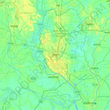
Name: Dhaka topographic map, elevation, terrain.
Average elevation: 7 m
Minimum elevation: -1 m
Maximum elevation: 23 m
Other topographic maps
Click on a map to view its topography, its elevation and its terrain.


Bashundhara Community Park
Bangladesh > Dhaka Division > Dhaka Metropolitan > Panchkhola
Average elevation: 4 m