
Horneburg topographic map
Interactive map
Click on the map to display elevation.
About this map
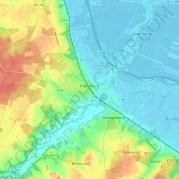
Name: Horneburg topographic map, elevation, terrain.
Location: Horneburg, Samtgemeinde Horneburg, Stade, Lower Saxony, Germany (53.48629 9.50924 53.52958 9.61722)
Average elevation: 15 m
Minimum elevation: -4 m
Maximum elevation: 45 m