
городское поселение Эсэ-Хайя topographic map
Interactive map
Click on the map to display elevation.
About this map
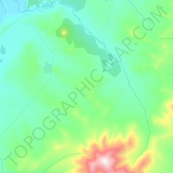
Name: городское поселение Эсэ-Хайя topographic map, elevation, terrain.
Average elevation: 349 m
Minimum elevation: 125 m
Maximum elevation: 1,620 m
Other topographic maps
Click on a map to view its topography, its elevation and its terrain.
Batagay
Russia > Sakha Republic > Verkhoyansky Ulus > Batagay
Batagay, городское поселение Батагай, Verkhoyansky Ulus, Sakha Republic, Far Eastern Federal District, Russia
Average elevation: 164 m