
Sorn topographic map
Interactive map
Click on the map to display elevation.
About this map
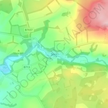
Name: Sorn topographic map, elevation, terrain.
Location: Sorn, East Ayrshire, Scotland, KA5 6HZ, United Kingdom (55.49070 -4.30890 55.53070 -4.26890)
Average elevation: 172 m
Minimum elevation: 98 m
Maximum elevation: 286 m