Geolocate

Pussey topographic map

Click on the map to display elevation.

About this map
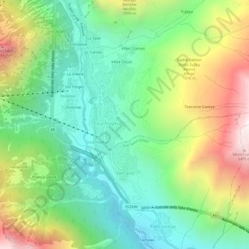
Name: Pussey topographic map, elevation, terrain.

Location: Pussey, Courmayeur, Aosta Valley, 11013, Italy (45.76716 6.95701 45.80716 6.99701)

Average elevation: 1,561 m

Minimum elevation: 1,022 m

Maximum elevation: 2,521 m

Gear up for your next adventure:

📍Handheld GPS Navigators - Reliable satellite navigation for hiking and off-road exploration
🧤Thermal Touchscreen Gloves - Stay warm while operating your GPS or smartphone camera
👟Men's Trail Running Shoes - Lightweight grip for fast movement over topographic contours
🍳Camping Stoves - Compact stoves for outdoor cooking
🥾Walking Shoes - Lightweight walking shoes for countryside and coastal paths

As an Amazon Associate, this site earns from qualifying purchases at no extra cost to you.