
Ridgecrest topographic map
Interactive map
Click on the map to display elevation.
About this map
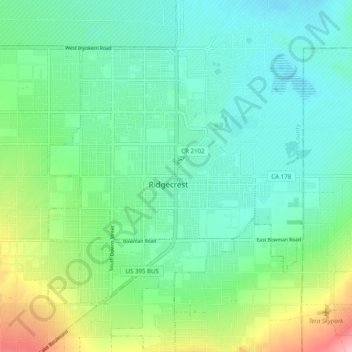
Name: Ridgecrest topographic map, elevation, terrain.
Average elevation: 716 m
Minimum elevation: 677 m
Maximum elevation: 821 m
Other topographic maps
Click on a map to view its topography, its elevation and its terrain.
18 Mile House, California
United States > California > CAL Fire Kern County
18 Mile House, California, CAL Fire Kern County, CAL Fire Southern Region, California, United States
Average elevation: 672 m
Ridgecrest
United States > California > CAL Fire Kern County
Ridgecrest, CAL Fire Kern County, CAL Fire Southern Region, California, 93555, United States
Average elevation: 739 m