
Walcott topographic map
Interactive map
Click on the map to display elevation.
About this map
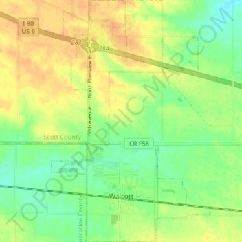
Name: Walcott topographic map, elevation, terrain.
Average elevation: 227 m
Minimum elevation: 210 m
Maximum elevation: 242 m
Other topographic maps
Click on a map to view its topography, its elevation and its terrain.
Park View
United States > Iowa > Scott County
Park View, Scott County, Iowa, United States
Average elevation: 235 m
Davenport
United States > Iowa > Scott County
Davenport, Scott County, Iowa, United States
Average elevation: 205 m
Le Claire
United States > Iowa > Scott County
Le Claire, Le Claire Township, Scott County, Iowa, United States
Average elevation: 200 m
Davenport
United States > Iowa > Scott County > Davenport
Davenport, Scott County, Iowa, 52801, United States
Average elevation: 212 m