Geolocate

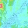
Semungkis River topographic map

Click on the map to display elevation.

About this map

Name: Semungkis River topographic map, elevation, terrain.

Location: Semungkis River, Batu 14 Hulu Langat, Kajang Municipal Council, Hulu Langat, Selangor, Malaysia (3.11855 101.82226 3.18803 101.82724)

Average elevation: 186 m

Minimum elevation: 46 m

Maximum elevation: 556 m

Other topographic maps

Click on a map to view its topography, its elevation and its terrain.
Gear up for your next adventure:

🧊Personal Water Filters - Drink safely from mountain streams marked on your map
🌄Compact Monoculars - Lightweight optics for hiking
🧥Packable Down Jackets - Lightweight warmth that compresses small in your bag
🎒Multi-day Trekking Packs - Large capacity backpacks for wild camping and long-distance trails
🍲Portable Camping Stoves - Fast-boiling stoves for hot meals on remote topographic survey trips

As an Amazon Associate, this site earns from qualifying purchases at no extra cost to you.