
Kettle River topographic map
Interactive map
Click on the map to display elevation.
About this map
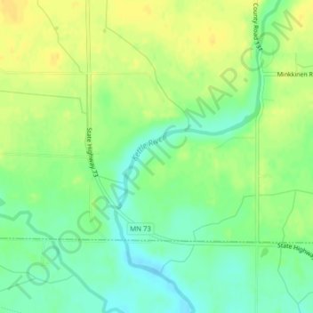
Name: Kettle River topographic map, elevation, terrain.
Location: Kettle River, Carlton County, Minnesota, 55757, USA (46.51087 -92.90384 46.51552 -92.89590)
Average elevation: 367 m
Minimum elevation: 354 m
Maximum elevation: 379 m
Other topographic maps
Click on a map to view its topography, its elevation and its terrain.
Lake Victoria
USA > Minnesota > Alexandria
Lake Victoria, Rosewood Circle Southeast, Alexandria, Douglas County, Minnesota, 56308, USA
Average elevation: 427 m
Keller Lake
Keller Lake, North Maplewood Drive, Maplewood, Ramsey County, Minnesota, 55109, USA
Average elevation: 272 m
Beebe Lake
Beebe Lake, County Road 82, Dalton, Otter Tail County, Minnesota, 56309, USA
Average elevation: 396 m
Falcon Heights
USA > Minnesota > Falcon Heights
Falcon Heights, Ramsey County, Minnesota, USA
Average elevation: 291 m
Oak Park Heights
USA > Minnesota > Oak Park Heights
Oak Park Heights, Washington County, Minnesota, USA
Average elevation: 257 m
Four Corners
USA > Minnesota > Four Corners
Four Corners, Saint Louis County, Minnesota, USA
Average elevation: 438 m
Cathedral Hill Park
USA > Minnesota > Saint Paul
Cathedral Hill Park, Saint Paul, Ramsey County, Minnesota, USA
Average elevation: 252 m
Rainy Lake
USA > Minnesota > Parkers Prairie Park
Rainy Lake, 108th Street, Parkers Prairie Park, Otter Tail County, Minnesota, 56361, USA
Average elevation: 438 m
Whittier
USA > Minnesota > Minneapolis
Whittier, Minneapolis, Hennepin County, Minnesota, USA
Average elevation: 268 m
Dunbar River
Dunbar River, Itasca County, Minnesota, 56681, USA
Average elevation: 404 m
Boga Lake
USA > Minnesota > Forest Center
Boga Lake, Forest Rt 376, Forest Center, Lake County, Minnesota, USA
Average elevation: 482 m
Alexandria
USA > Minnesota > Alexandria
Alexandria, Douglas County, Minnesota, 56308, USA
Average elevation: 426 m