
Bidoup - Nui Ba National Park topographic map
Interactive map
Click on the map to display elevation.
About this map
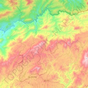
Name: Bidoup - Nui Ba National Park topographic map, elevation, terrain.
Average elevation: 1,312 m
Minimum elevation: 529 m
Maximum elevation: 2,270 m
Other topographic maps
Click on a map to view its topography, its elevation and its terrain.
Bản Đơng Mang
Vietnam > Lâm Đồng Province > Lạc Dương District > Bản Đơng Mang
Average elevation: 1,597 m