
Dekanat Ujazd Śląski topographic map
Interactive map
Click on the map to display elevation.
About this map
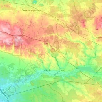
Name: Dekanat Ujazd Śląski topographic map, elevation, terrain.
Average elevation: 231 m
Minimum elevation: 172 m
Maximum elevation: 313 m
Other topographic maps
Click on a map to view its topography, its elevation and its terrain.
Strzelce Opolskie
Poland > Opole Voivodeship > Strzelce County > Strzelce Opolskie > Strzelce Opolskie
Average elevation: 238 m
Góra Świętej Anny
Poland > Opole Voivodeship > Strzelce County > Góra Świętej Anny
Average elevation: 321 m