
Thank you for supporting this site ❤️
Make a donation
Make a donation
Gear up for your next adventure:
As an Amazon Associate, this site earns from qualifying purchases at no extra cost to you.
Torsa topographic map
Click on the map to display elevation.
Thank you for supporting this site ❤️
Make a donation
Make a donation
Gear up for your next adventure:
As an Amazon Associate, this site earns from qualifying purchases at no extra cost to you.
About this map
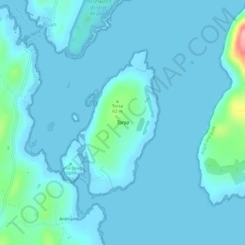
Name: Torsa topographic map, elevation, terrain.
Location: Torsa, Ardinamir, Argyll and Bute, Scotland, United Kingdom (56.24997 -5.62629 56.26581 -5.60703)
Average elevation: 12 m
Minimum elevation: 0 m
Maximum elevation: 141 m
Argyll and Bute trails, hiking, mountain biking, running and outdoor activities
Thank you for supporting this site ❤️
Make a donation
Make a donation
Gear up for your next adventure:
As an Amazon Associate, this site earns from qualifying purchases at no extra cost to you.