
Laagri alevik topographic map
Interactive map
Click on the map to display elevation.
About this map
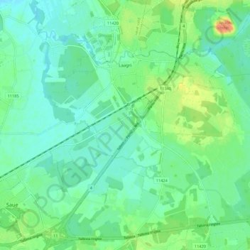
Name: Laagri alevik topographic map, elevation, terrain.
Location: Laagri alevik, Saue vald, Harju maakond, 76401, Estonia (59.31006 24.56704 59.36464 24.64726)
Average elevation: 36 m
Minimum elevation: 25 m
Maximum elevation: 61 m
Other topographic maps
Click on a map to view its topography, its elevation and its terrain.