
Bor topographic map
Interactive map
Click on the map to display elevation.
About this map
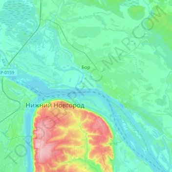
Name: Bor topographic map, elevation, terrain.
Average elevation: 87 m
Minimum elevation: 60 m
Maximum elevation: 205 m
Other topographic maps
Click on a map to view its topography, its elevation and its terrain.
Иваново
Russia > Nizhny Novgorod Oblast > городской округ Бор
Иваново, городской округ Бор, Nizhny Novgorod Oblast, Volga Federal District, Russia
Average elevation: 89 m