
Prado del Rey topographic map
Interactive map
Click on the map to display elevation.
About this map
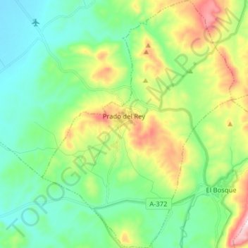
Name: Prado del Rey topographic map, elevation, terrain.
Location: Prado del Rey, Cádiz, Andalusia, 11660, Spain (36.73310 -5.59999 36.83595 -5.50013)
Average elevation: 313 m
Minimum elevation: 144 m
Maximum elevation: 712 m