
Luis Gil Pérez topographic map
Interactive map
Click on the map to display elevation.
About this map
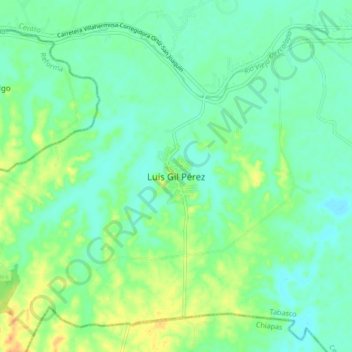
Name: Luis Gil Pérez topographic map, elevation, terrain.
Location: Luis Gil Pérez, Centro, Tabasco, México (17.83541 -93.11135 17.91541 -93.03135)
Average elevation: 14 m
Minimum elevation: 2 m
Maximum elevation: 38 m
Other topographic maps
Click on a map to view its topography, its elevation and its terrain.