
Latheron topographic map
Interactive map
Click on the map to display elevation.
About this map
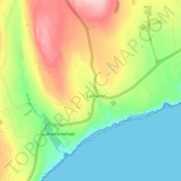
Name: Latheron topographic map, elevation, terrain.
Location: Latheron, Caithness, Scotland, KW5 6DN, United Kingdom (58.26421 -3.39014 58.30421 -3.35014)
Average elevation: 76 m
Minimum elevation: -1 m
Maximum elevation: 192 m
Scotland trails, hiking, mountain biking, running and outdoor activities