
Oliver topographic map
Interactive map
Click on the map to display elevation.
About this map
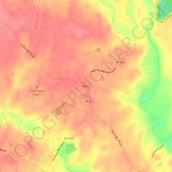
Name: Oliver topographic map, elevation, terrain.
Location: Oliver, Hanover County, Virginie, États-Unis d'Amérique (37.83820 -77.55276 37.87820 -77.51276)
Average elevation: 66 m
Minimum elevation: 2 m
Maximum elevation: 90 m