
Camano Island topographic map
Interactive map
Click on the map to display elevation.
About this map
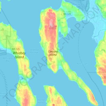
Name: Camano Island topographic map, elevation, terrain.
Average elevation: 27 m
Minimum elevation: -3 m
Maximum elevation: 207 m
Other topographic maps
Click on a map to view its topography, its elevation and its terrain.
Oak Harbor
United States > Washington > Island County
Oak Harbor, Island County, Washington, United States
Average elevation: 31 m