
Кез topographic map
Interactive map
Click on the map to display elevation.
About this map
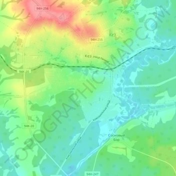
Name: Кез topographic map, elevation, terrain.
Location: Кез, Kezsky District, Udmurtia, Volga Federal District, Russia (57.86075 53.67051 57.91578 53.75332)
Average elevation: 194 m
Minimum elevation: 167 m
Maximum elevation: 255 m