
Westhoughton topographic map
Interactive map
Click on the map to display elevation.
About this map
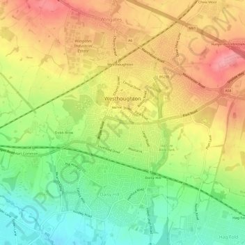
Name: Westhoughton topographic map, elevation, terrain.
Average elevation: 95 m
Minimum elevation: 43 m
Maximum elevation: 144 m
Other topographic maps
Click on a map to view its topography, its elevation and its terrain.
Westhoughton
United Kingdom > England > Westhoughton
Westhoughton, Greater Manchester, North West England, England, BL5 3TD, United Kingdom
Average elevation: 95 m