Geolocate

Tacloban topographic map

Click on the map to display elevation.

About this map

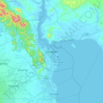
Name: Tacloban topographic map, elevation, terrain.

Location: Tacloban, Leyte, Eastern Visayas, 6500, Philippines (11.08303 124.84814 11.40303 125.16814)

Average elevation: 29 m

Minimum elevation: -1 m

Maximum elevation: 562 m

Gear up for your next adventure:

🧰First Aid Kits - Essential safety kits for outdoor activities
🧦Hiking Socks - Breathable socks designed to prevent blisters on long walks
🎒Hiking Daypacks (20L) - Compact backpacks for day trips and technical mountain ascents
🛌Sleeping Mats - Insulated mats for comfortable outdoor sleeping
🎒Backpack Rain Covers - Universal waterproof covers to protect your gear from downpours

As an Amazon Associate, this site earns from qualifying purchases at no extra cost to you.