
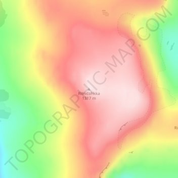
Ritničohkka topographic map
Interactive map
Click on the map to display elevation.
About this map
Name: Ritničohkka topographic map, elevation, terrain.
Average elevation: 1,154 m
Minimum elevation: 951 m
Maximum elevation: 1,306 m
Other topographic maps
Click on a map to view its topography, its elevation and its terrain.
Halti
Finland > Northern Finland > Enontekiö
Halti, Enontekiö, Tunturi-Lapin seutukunta, Lapland, Northern Finland, Mainland Finland, Finland
Average elevation: 1,192 m