
Sutru pagasts topographic map
Interactive map
Click on the map to display elevation.
About this map
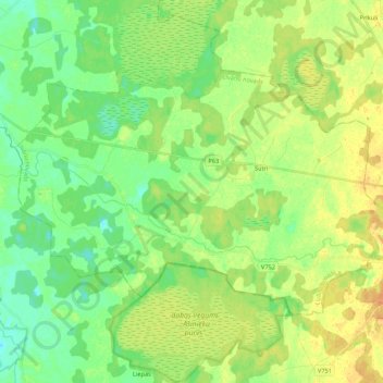
Name: Sutru pagasts topographic map, elevation, terrain.
Location: Sutru pagasts, Līvānu novads, Latgale, Latvia (56.26622 26.39572 56.34322 26.61113)
Average elevation: 104 m
Minimum elevation: 91 m
Maximum elevation: 119 m