
Deatsville topographic map
Interactive map
Click on the map to display elevation.
About this map
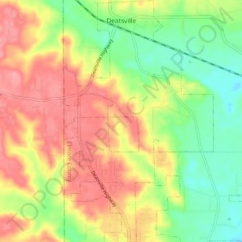
Name: Deatsville topographic map, elevation, terrain.
Location: Deatsville, Elmore County, Alabama, 36022, United States (32.55422 -86.41253 32.61263 -86.36895)
Average elevation: 114 m
Minimum elevation: 68 m
Maximum elevation: 158 m
Other topographic maps
Click on a map to view its topography, its elevation and its terrain.