
Titlis topographic map
Interactive map
Click on the map to display elevation.
About this map
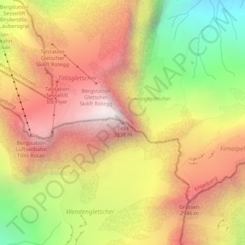
Name: Titlis topographic map, elevation, terrain.
Average elevation: 2,520 m
Minimum elevation: 1,625 m
Maximum elevation: 3,233 m
Other topographic maps
Click on a map to view its topography, its elevation and its terrain.
Innertkirchen
Switzerland > Bern > Interlaken-Oberhasli administrative district > Innertkirchen
Innertkirchen, Interlaken-Oberhasli administrative district, Oberland administrative region, Bern, 3862, Switzerland
Average elevation: 1,945 m
Spis
Switzerland > Bern > Interlaken-Oberhasli administrative district > Innertkirchen > Äppigen
Spis, Äppigen, Innertkirchen, Interlaken-Oberhasli administrative district, Oberland administrative region, Bern, 3862, Switzerland
Average elevation: 871 m